Professional Aerial Services for Data, Monitoring & Inspection
Clear Data. Better Decisions.
Clear Data. Better Decisions.
Our professional aerial services deliver clear, actionable data to help you monitor, inspect, and plan with confidence.
Gain clear visibility into site activity and project evolution through regular aerial monitoring and visual progress documentation.
Use cases
- Site progress tracking
- Visual records over time
- Remote status verification
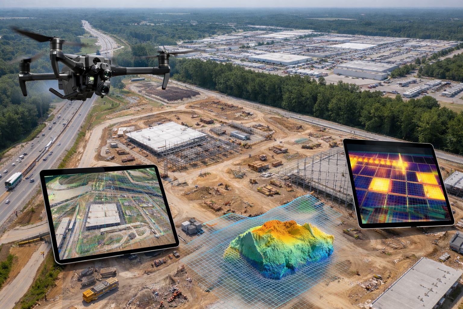
Accurate aerial data collection to support planning, analysis, and informed decision-making across a wide range of operations.
Use cases
- Orthomosaic mapping
- Topographic data
- Area and volume measurements
Safe, efficient aerial inspections to identify conditions, issues, and changes that are difficult or costly to assess from the ground.
Use cases
- Infrastructure inspection
- Asset condition assessment
- Visual and thermal inspection support

At 2S Aerial Services, we provide professional aerial data solutions to help organizations gain clear visibility into their operations.
Our focus is on delivering accurate, reliable, and timely aerial data that supports monitoring, inspection, and informed decision-making.
By combining certified aerial operations with modern data capture technologies, we help clients better understand site conditions, track progress, and identify potential issues without disrupting day-to-day activities.
We work with organizations across multiple industries, adapting our services to meet specific operational needs while maintaining a strong emphasis on safety, accuracy, and clarity.
Clear data leads to better decisions — and that is at the core of everything we do.